Day 4
June 15, 2012Today was filled with training exciting new equipment! First my group learned how to use the Trimble GPS unit. This unit can create shapefiles of vector features that can be put directly into ArcGIS or other formats. We also used the Garmin units to collect data points and then loaded them into DNR online software put out by Garmin. We also loaded these points into Google Earth. I was impressed by this because it was so easy and “real time”.
After this we used the X-Ray Floresence device( XRF). This is an X-ray device used to examine the energy release by the atoms of different kinds of field samples such as bed rock or soil. We can use this equipment to examine the potassium and phosphorus levels in the soil and bedrock on Kauai to determine the productivity of the landscape. This is an exciting piece of equipment that can really help us determine what humans did to change their environments growing capabilities in the past.
After lunch we used the spectrometer to examine plant life around campus. This piece of equipment measures what parts of the electromagnetic spectrum is being absorbed and which parts are being reflected by plant life. There is talk about using this piece of equipment in conjunction with remote sensing to better classify vegetation types.
After this Dr.Lipo gave an exciting lecture on Polynesia and touched on his Easter Island studies. I have already read his book The Statues that Walked and loved getting to hear some of these topics from him. I am still looking forward to asking him “Dr.Lipo, what is up with Rapa Nui and hats?”.
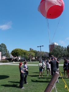
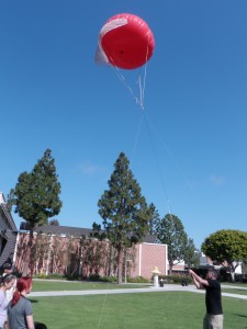
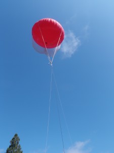
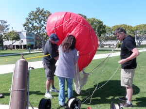
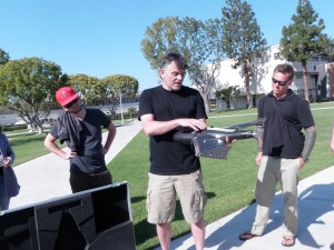
Then we went out to make some test flights with the blimp. This is a piece of equipment that can be used on Kauai to take cost effective RMS images of small areas using normal cameras. It was not what I expected. I suppose I envisioned something elliptical and silver but the blimp was red and shaped more like a weather balloon. Getting it aired up and functional went …pretty smoothly but however the flying part did not go so well. This is an area where I believe our team could use some military style training and communication methods. Having a pre-defined set of words that translate into certain actions or concerns would really benefit the navigation of this balloon among so many people spaced to far apart. My string got tangled into the spring on the locking mechanism of the reel I was using. We also where using the expensive cameras and as the balloon swung dangerously close to the trees it became apparent we should not have used the GateWings expensive cameras on a test fight! This was very stressful exercise but I felt that it was over all a good example of the capabilities of this type of remote sensing. We also got to see the GateWing up close and personal for the first time. It is truly amazing what people with know how and a great idea can do with normal hobby shop toys and some great software….and what those innovative people can charge for that equipment.
Below are some pictures of the balloon flight.