
Georectification and hillshades
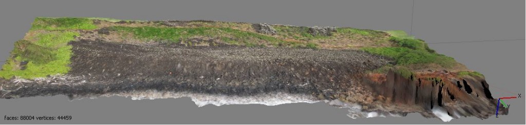
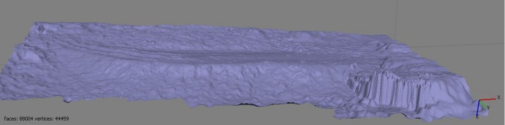
June 27, 2012I have spent the majority of today manipulating KAP (kite aerial photography) acquired imagery for the creation of DEMs (digital elevation models) of Hoouluia heiau. Lawrence, Paul, and I started with the georectification of aerial photographs previously aligned in Agisoft Photoscan. The image was tied into GPS coordinates obtained with a Trimble GeoXH which allows the merging of pictures with other georeferenced images such as Worldview satellite data. Following georectification, we attempted to develop a DEM of the heiau. My goal was to explore the value of slope and aspect analysis as a tool for extracting topographical information from imagery that otherwise appears as a featureless conglomerate of rocks. A point cloud was imported into ArcMAP, and a good portion of the day was spent interpreting the information. We did not succeed in constructing relevant slope and aspect models for Hoouluia, thus showing that this approach to spatial analysis may not be the most helpful. LIDAR data may then prove to be the best method for creating 3-dimensional models of large basalt structures. However, simple hill-shade modeling did create useful data when revisiting the information in Agisoft Photoscan. The resulting images (see example below) could prove fruitful in the observation of structural attributes not readily visible from nadir perspective photographs.
– John Thornton O’Connor