
I get by with a little help from my friends
June 29, 2012Today was filled with learning experiences left and right. We spent the day in the lab again and I ended up getting a lot accomplished with constant help from my peers and advisors. I ended up working out a rough classification system for an inset of my total study area using a program called eCognition. I will generally go through the steps below.
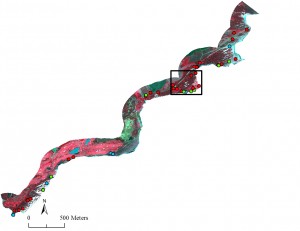
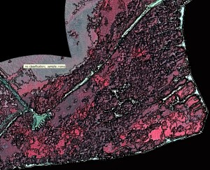
The above is my study area which is a segment of the general study area in SE Kauai within a 250 meter buffer of the coast. The points represent locations where I took waypoints at patches of vegetation – red represents alien species, green represents native, and blue represents mixed native/alien patches. I imported this image into eCognition and took a subset of the box. Then I ran a segmentation on it and ended up with the below image.
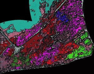
After this I designed a set of classes which I used to classify my segments. I selected individual segments based on which plants I knew were growing there as it shows in the below image. Each color represents a different class (purple is ironwood, green is naupaka, light blue is grass, etc).
Then I ran a classification tool and came up with the following image. The program took the samples that I classified and then assigned the rest of the polygons a class based on their spectral readings.
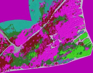
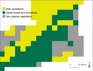
After this I imported it into ArcMap and made the colors a little more attractive.

This classification can be compared with the preexisting GAP analysis that had been done on the island (30 meter resolution) and an obvious advantage becomes clear.
We did group and individual presentations tonight and all did very well! Phew!