
NTBG, Makauwahi, and airborne remote sensing platforms
June 18, 2012Howzit,
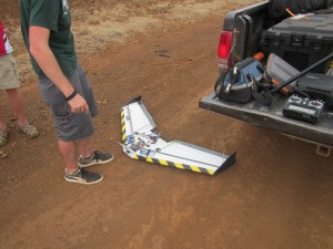
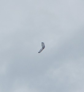
This morning, our research group became acquainted with the south side of Kauai. We began our day at the National Tropical Botanical Garden in Lawai Valley. Dr. Burney led us on a tour of the research facilities, and then we headed down into the gardens. NTBG has acquired a living collection of thousands of plants from around the world. McBryde Garden itself includes many plants that are actually extinct in the wild and therefore only preserved in botanical research collections such as that at Lawai. Following a discussion of native, invasive, and Polynesian-introduced plants, our group traveled to the Makauwahi Cave Reserve located just east of Poipu. We had a quick bite to eat and then spent some time exploring the plant collections around the sinkhole. Chuck and Dave, fellow UH Manoa students, had just flown over from Oahu with a fixed-wing aircraft and a kite to perform airborne image documentation. Images had already been recorded for the vegetation grid adjacent to Makauwahi. However, the wind was up to 30 mph in the afternoon and made further kite flying impossible. Our group took the equipment into the middle of an agricultural field so that Dave could fly the remote control single-wing. Below are two photographs of the aerial unit.
The images available from this platform will provide our first information for the field system in Mahaulepu. I will be posting images as they become available. Tomorrow will begin with more kite photography as we proceed full speed ahead into our remote sensing data acquisition.
– John Thornton O’Connor