Presentation Time
June 29, 2012Today, Avery and I went to the National Tropical Botanical Garden for some data processing time. I worked through georeferencing the orthophoto made from the Gatewing X100 imagery. It seems to match up pretty well except for the very top of a path that leads into the quarry, but for the purposes of my project that area is not important. Dr. Burney and I then met up to discuss areas that needed to be addressed in the restoration plan. We decided on three “layers”: hydrology, vegetation, and archaeology. I digitized (very roughly on paint) the plan for the presentation later in the day. I plan to do it properly and create shape files for everything once processing is more underway. At night, I presented about my research so far.
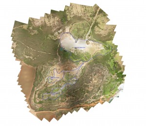
Georeferenced Picture of the Quarry:
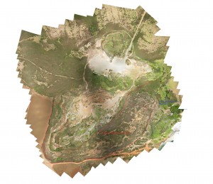
Vegetation Layer: (Click on the picture to see the outline)
Archaeology Layer: (Click on the picture to see the outlines)

Hydrology Layer: (Click on picture to see outlines)