
Quarry surveys and the Gatewing x100
June 24, 2012Post for 6-22-12, delayed due to technical difficulties:
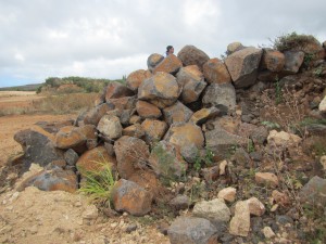
Friday morning, our research group took an excursion to the Grove Farms Quarry located adjacent to Makauwahi Cave for a reconnaissance survey. GPS points were taken for various features as we attempted to locate other natural resources. We viewed the location of what was once Waiopili heiau, a large hoouluulu structure that was positioned where the regional stream system previously met the ocean. The heiau had been destroyed several decades ago by the landowners as a way of avoiding possible cultural and political resistance to alternative land use. A large section of the land was subsequently converted into a limestone quarry. A few heiau stones were identified, but the land has been heavily scarred by mining use (see below).
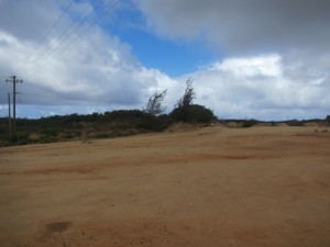
Dr. Burney hopes to convert much of the carved-out land into a wetland preserve similar to what previously existed there. After checking out the lower quarry, we proceeded to the upper quarry as accessed from the Makauwahi trail. Similar survey activities were completed for this area, and we chased a goat that the Burneys wish to remove from the property. We didn’t catch the goat.
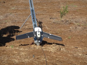
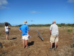
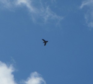
Today was also the first flying of the Gatewing x100. Dr. Lee, Dr. Wechsler, and Ted Ralston spent the morning assembling and programming the unit. We joined the professors later in the afternoon. The Gatewing x100 is a UAV (unmanned aerial vehicle) that can be equipped with different cameras for the acquisition of complex aerial imagery. The unit operates according to a predetermined flight path programmed by the research team. Dr. Wechsler programmed the unit to fly transects over Makauwahi Cave, the vegetation grid, and adjacent agricultural fields. Images were recorded in real-color and near-infrared at 5 centimeter resolution from an altitude of 150 meters. The first x100 mission was aborted early and landed without a problem. The second mission went off without a hitch and was great to watch. The recorded images will allow detailed mapping for the area. Below are photos of the x100 on its launcher, immediately post-launch, and during an overhead fly-by.
– John Thornton O’Connor